Inquire ApplicationRequest Site Access
Curious about the progress of a site under construction? See our tower progress page here.
Longitude (DMS): 75°59'08.32"W
Longitude (DEC): -75.985644
Longitude (DEC): -75.985644
Latitude (DMS): 39°8'45.85"N
Latitude (DEC): 39.146069
Latitude (DEC): 39.146069
Development Status: Construction Ready
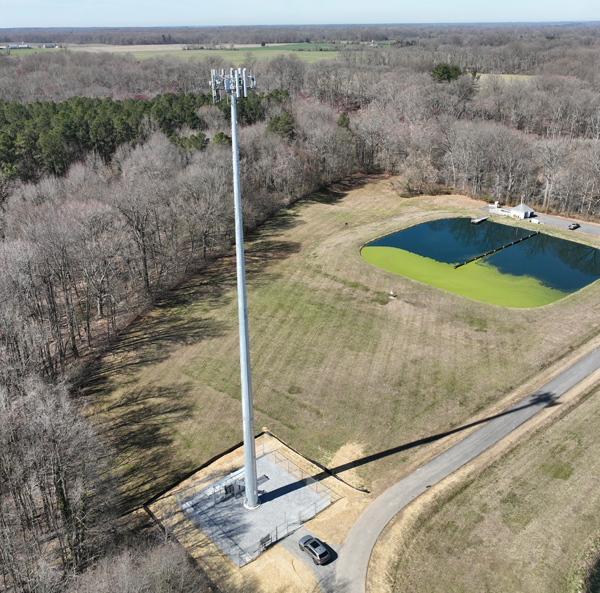
Structure Type: Monopole
Height: 195'
Ground Elevation: 38'
Appurtenances AMSL: 223'
Available Mounting Heights: 169' 157' 145' 133'
Compound Size: 50'x50'
Structure Type: Monopole
Height: 195'
Ground Elevation: 38'
Appurtenances AMSL: 223'
Available Mounting Heights: 169' 157' 145' 133'
Compound Size: 50'x50'
Address: 99 Water Way Drive
State: Maryland
County: Queen Anne's
Jurisdiction: Town of Church Hill
Zoning: Resource Conservation
Tenant Ready: YES - VZW Installed
Contact Person: leasing (at) calvertcrossland (dot) com
State: Maryland
County: Queen Anne's
Jurisdiction: Town of Church Hill
Zoning: Resource Conservation
Tenant Ready: YES - VZW Installed
Contact Person: leasing (at) calvertcrossland (dot) com
Comments: